Laboratory of Epidemiology and Public Health
60 College Street, New Haven, CT 06510
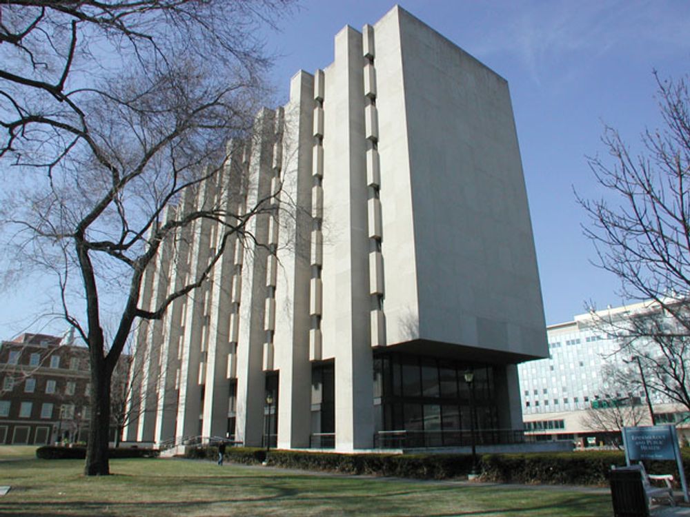
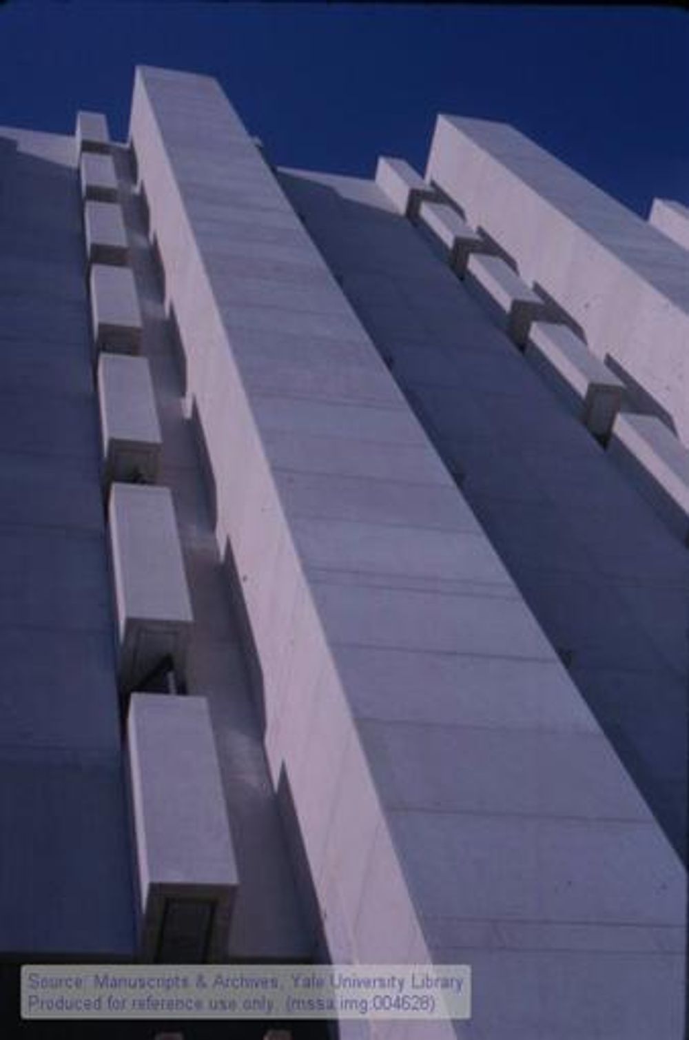
With its clean concrete frame and rectilinear ornamentation, the building on 60 College Street conceals the activity happening within. Its small windows are nearly unnoticed in the architecture. Even the glass podium does not reveal much, as it is recedes into the building (1). As imposing and closed off as it may seem from the streets, the Laboratory of Epidemiology and Public Health (LEPH) is open to affiliated students and visitors. From inside the block, LEPH is surrounded by greenery and open walkways. It’s settled on the corner of a block containing many of Yale’s Medical School buildings. Among these buildings, LEPH stands out against the neighboring façades. Its tan, geometric construction is stark against the red brick loft style structures around it—fitting as it is the only building to be both a part of Yale’s School of Medicine and Yale’s School of Public Health (2).
Since the construction of this building, there has not been a change in ownership or tenancy (1).
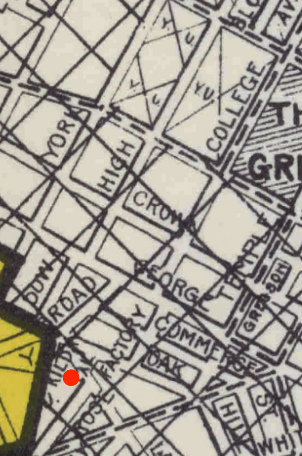
60 College Street, New Haven, CT was not always a working address. In fact, before the late 1950s, the street layout of the northern Hill area was entirely different (13, 14, 15). What is currently a research park and a civically exacerbated environment, was once a vibrant community of residents and workers—diverse in ethnicity, religion, and interest (17, 18, 19).
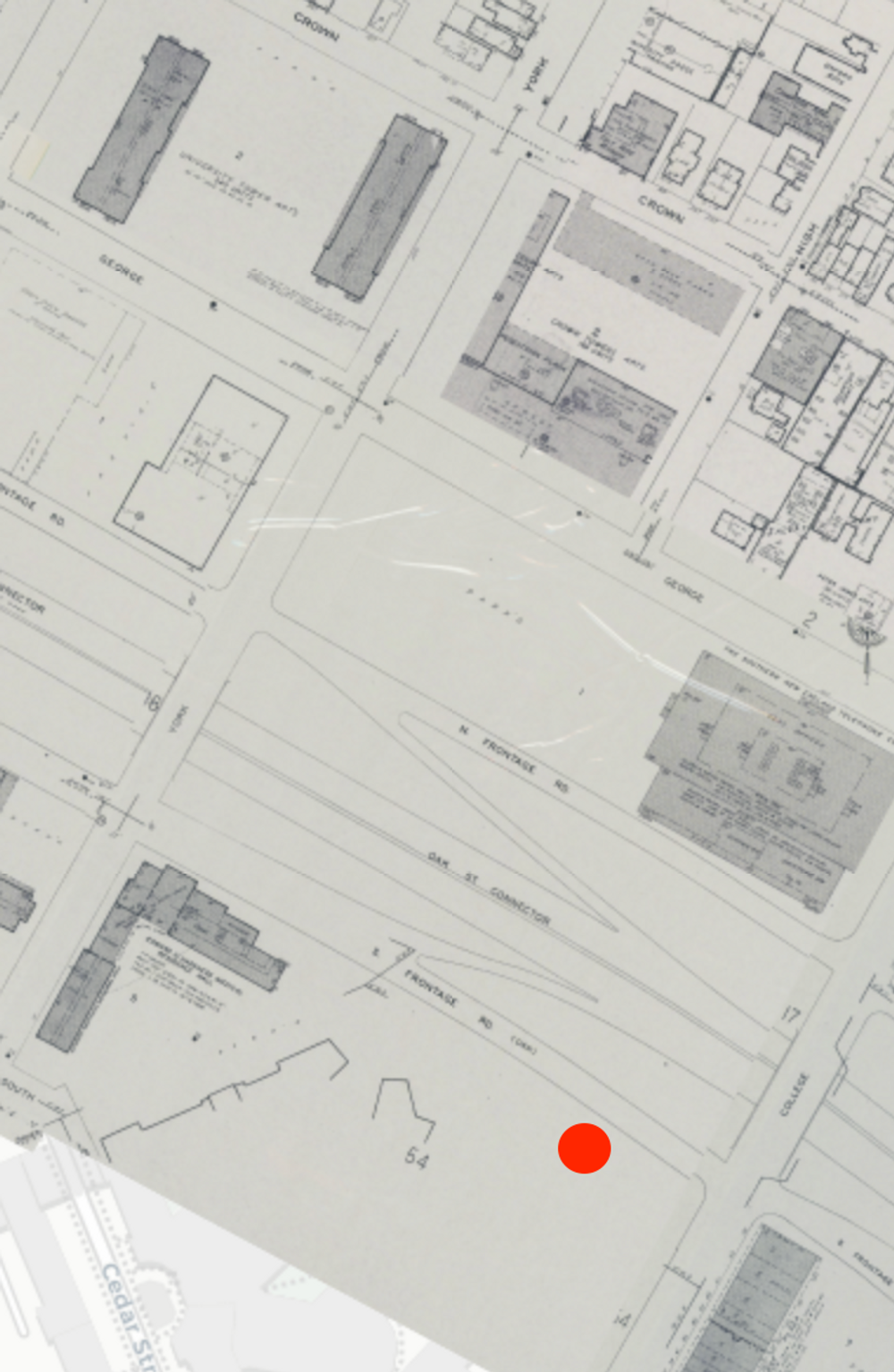
In 1957, a large plot of land south of Oak Street was demolished and rearranged. Hundreds of businesses and twice as many households were displaced. Richard C. Lee, mayor at the time, took advantage of the immigrant families settled in the neighborhood. Using their housing as a reason—he argued that there was a potential for deterioration into slums—, Lee excused his actions. Oak Street was replaced by the Oak Street Connector, a highway section of Route 34 (7). It was not just the mayor, though. City planners had this same goal, along with others in mind. Notably, Maurice Rotival’s city plan involved the centering of the city around Downtown New Haven, elimination of slums, and the “consolidation of Yale as a resource for the city” (6). True, the Oak Street Connector resulted in part from the country’s highway craze. However, it was also built to purposely remove certain demographics (the ones kicked out) and to satisfy others (indirectly satisfied those in charge of the city, through Yale). The resulting area south of the Oak Street Connector became Yale’s medical-hospital complex, a new Oak Street neighborhood, new residential/market spaces, and a railroad station (6).
Decades later, animosity towards the Oak Street Connector still existed. In 2013, efforts were made to try and reconnect the Hill to Downtown New Haven. The Downtown Crossing project includes, among other things, pocket parks, new bike lanes in place of highway ramps, and real estate development. Vacant and run-down plots are also being converted into usable commercial space (7). It will be some time before New Haven’s homeless population is effectively reduced, and it will be an even longer before the neighborhood’s cultural damage is rectified. In a way, LEPH and all of the Yale’s buildings in the Hill represents a recurring subject in architectural history: the applications and ramifications of power.
Built in 1963, LEPH stands as a relatively recent addition to New Haven. It was commissioned by Yale and has not changed ownership since. The initial architect, Philip Johnson, was no stranger to Yale’s campus. Johnson had been working on Yale’s Kline Biology Tower when he was asked to design LEPH. He shared during an interview that the design process for LEPH was fast and easy, but that the final look was not what he had in mind. Johnson had given the project over to a second architect, the Office of Douglas Orr, whom he blames for the aspects of the building that he considers aesthetic mistakes. Notably, Johnson fixates on the small windows which contradict his original plans for a bolder look. (1)
Regardless of the construction mishaps between the two lead architects, LEPH represents and holds an impressive entity. LEPH came to be as a result of a new graduate department at Yale: the Department of Epidemiology and Public Health. Originally, this department began as a concentration under Yale’s Medical School. Its accreditation in 1946 made it not only one of the first 8 accredited schools for public health, but also uniquely a professional public health school that simultaneously branches off a separate graduate program. The year after LEPH was built, the Department of Epidemiology and Public Health moved in. The department is still located there today. (3)
While LEPH houses a globally renowned institution, it also encompasses local tensions. Urban renewal—the process of redeveloping areas in cities, usually involving the clearance of slums— is a problem commonly seen throughout New Haven (20). The imposition of Yale buildings into organic neighborhoods has always been somewhat disruptive. Within the neighborhood, the Hill, the placement of the majority of Yale Medical School buildings and Yale-affiliated hospitals have created a strain between local residents and university faculty and students. Though university “research parks,” like the one LEPH is located in, results in more federal and state funding, benefits are largely not shared with the local community (5). The fundamental problem here reflects a large theme in general history—that is, an affluent agent imposing itself on established territory for unequal profit.
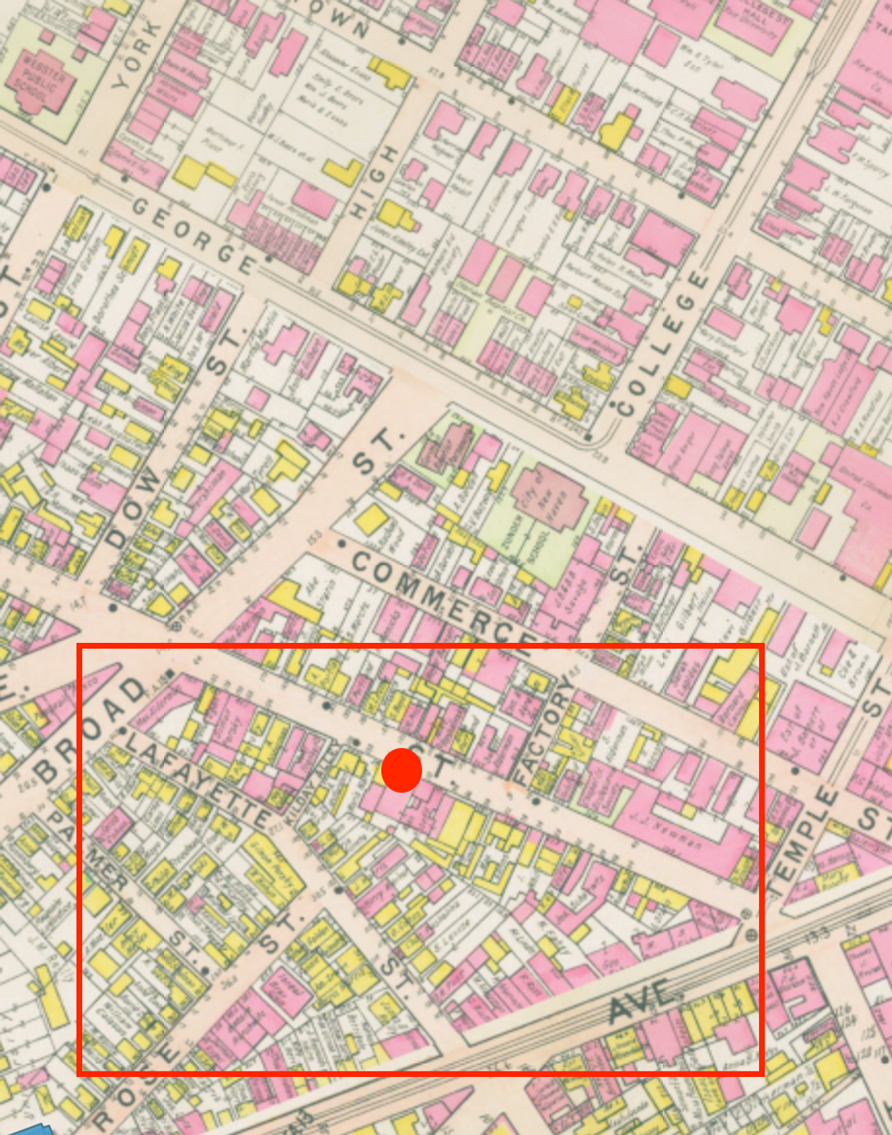
LEPH is situated in a region of high building density (1). It sits on an irregularly shaped block containing most of Yale’s medical studies buildings (3). Many buildings in the area are either institutional, commercial, or residential (1). Examples of nearby establishments include a corporate office building, a restaurant, a bank, and a hospital (3). A bus station is located right next to LEPH and there are multiple parking lots, all less than a block away (4).
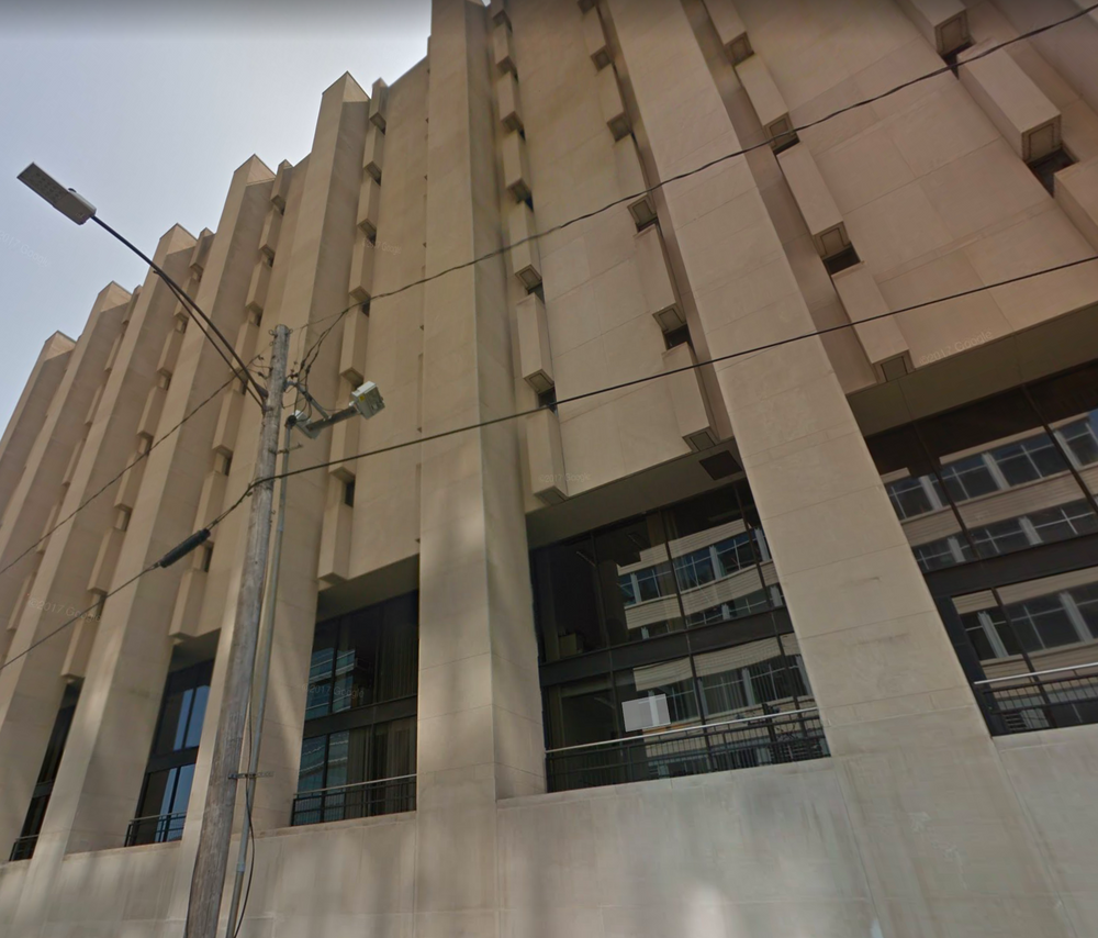
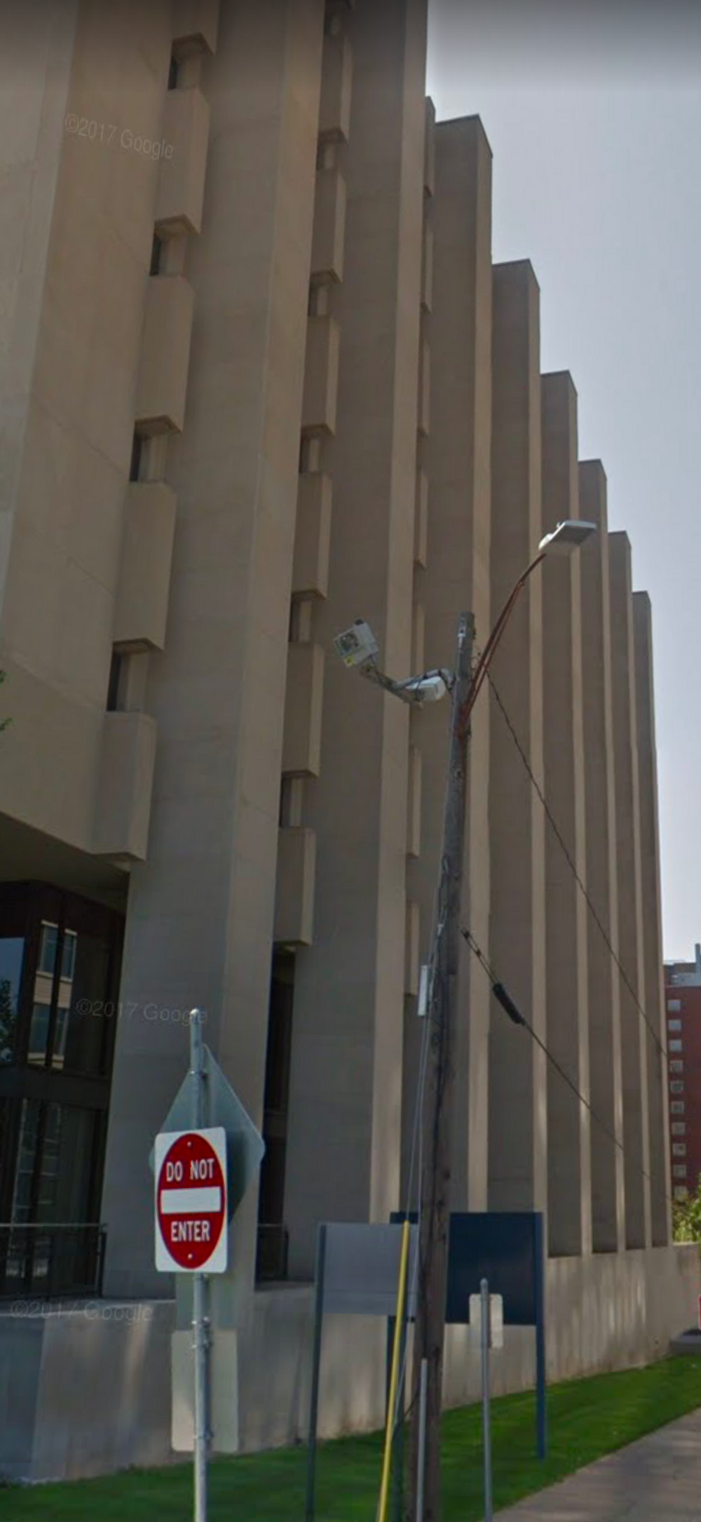
At 9 stories tall, LEPH does not quite tower over the structures surrounding it. However, held up by large, concrete pilasters—8 on each longitudinal side and clearly visible on the exterior—the building is stretched upwards. Combined with the 2 story glass podium, slightly hidden behind the supportive columns, LEPH has the illusion of being more than it actually is. By nature of the podium’s recessed design, the exterior is made to look thick and blockish. The heavyset masonry hoods, jutting outwards and sandwiching the building’s small windows, fortifies this aesthetic interpretation. Yet, these linear embellishments also create a sort of charm—there is elegance in the simplicity and repetition of the building. The lower level’s glass walls, concrete overhang, and lush surrounding greenery proposes the notion of a comfortable—modern, even—academic space (1). In line with that, LEPH has been consistently renovated and updated to maintain its stance as a top rated program and facility (3, 16).
(1) New Haven Historic Resources Inventory (New Haven: The New Haven Preservation Trust). File no. 163.
(2) Yale School of Public Health. (2017, December 12). YSPH at a Glance. Retrieved February 26, 2018, from http://publichealth.yale.edu/about/
(3) Google. (2017). [Google Maps for Laboratory of Epidemiology and Public Health]. Retrieved February 26, 2018, from https://goo.gl/maps/yxpFXhbUvw92
(4) Yale School of Public Health. (2018). YSPH Buildings and Locations [Map]. In Maps and Directions | Yale School of Public Health. Retrieved February 26, 2018, from https://publichealth.yale.edu/about/map.aspx?organizationId=109082
(5) Klein, J. (2015, Winter). New Haven Rising. Retrieved February 26, 2018, from https://www.dissentmagazine.org/article/new-haven-rising
(6) Domhoff, G. W. (2005, September). Who Really Ruled in Dahl's New Haven: More Details. Retrieved February 26, 2018, from https://www2.ucsc.edu/whorulesamerica/local/new_haven_details.html
(7) Zanghi, A. (2016, September 28). Making a Better City Out of 'Model City'. Retrieved February 26, 2018, from https://www.citylab.com/equity/2016/09/making-a-better- city-out-of-model-city/499679/
(8) Yale University Maps. (n.d.). Laboratory of Epidemiology & Public Health [60 College St]. Retrieved February 26, 2018, from https://map.yale.edu/place/building/LEPH?
(9) Google Maps. (n.d.). [Rendered View of Yale's Medical Block in the Hills, New Haven]. Retrieved February 26, 2018.
(10) Google Maps. (n.d.). [Street View of The Laboratory of Epidemiology and Public Health, Looking Up]. Retrieved February 26, 2018.
(11) Google Maps. (n.d.). [Street View of The Laboratory of Epidemiology and Public Health, Side View]. Retrieved February 26, 2018.
(12) Johnson, R. (1964). Laboratory of Epidemiology and Public Health, Yale University, 60 College Street. Slide 000077. [Digital image]. Retrieved February 26, 2018, from http:// images.library.yale.edu/madid/oneItem.aspxid=1775143&q=Philip%20johnson&q1=&q
2=&qc1=&qc2=&qf1=&qf2=&qn=&qo=&qm=&qs=&sid=&qx=
(13) [Screenshot of Atlas of New Haven, 1911]. (n.d.). Retrieved February 26, 2018, from http://gatheringabuilding.yale.edu/#/routes/historical-geography#6
(14) [Screenshot of New Haven Residential Security Map]. (n.d.). Retrieved February 26, 2018,from http://gatheringabuilding.yale.edu/#/routes/historical-geography#6
(15) [Screenshot of Sanborn Fire Insurance Map, 1973]. (n.d.). Retrieved February 26, 2018, from http://gatheringabuilding.yale.edu/#/routes/historical-geography#6
(16) Permits from the City of New Haven Building Department, ranging from 1977 to 2016. Permits vary from HVAC to interior lab renovations.
(17) New Haven Directory (New Haven: Price & Lee Co., 1944-1945)
(18) New Haven Directory (New Haven: Price & Lee Co., 1950)
(19) New Haven Directory (New Haven: Price & Lee Co., 1960)
(20) urban renewal. (n.d.). Dictionary.com Unabridged. Retrieved March 8, 2018 from Dictionary.com website http://www.dictionary.com/browse/urban-renewal
Saved edits to this building (newest first). Each row is logged when an editor saves changes.
| When | Editor |
|---|---|
| Feb 25, 2026, 12:04 PM ET | yumpEditor |
Researcher
Vicky Wu
Entry Created
February 25, 2018 at 4:38 PM EST
Last Updated
February 25, 2026 at 12:04 PM EST by yumpEditor
Style
PostmodernBrutalistCurrent Use
InstitutionalCollege / UniversityMedicalEra
Neighborhood
Yale CampusHillYear Built
1963
Architect
Philip Johnson, Office of Douglas Orr
Current Tenant
Yale School of Public Health
Roof Types
FlatStructural Conditions
Good
Street Visibilities
Yes
Threats
None knownExternal Conditions
Good
Dimensions
1st-2nd Fl: 62' x 230'; 3rd-9th Fl: 50' x 202'
Street Visibilities
Yes
Owner
Yale University
Ownernishp Type
Yale
Client
Yale University
Historic Uses
InstitutionalWarehouse/StorageMedical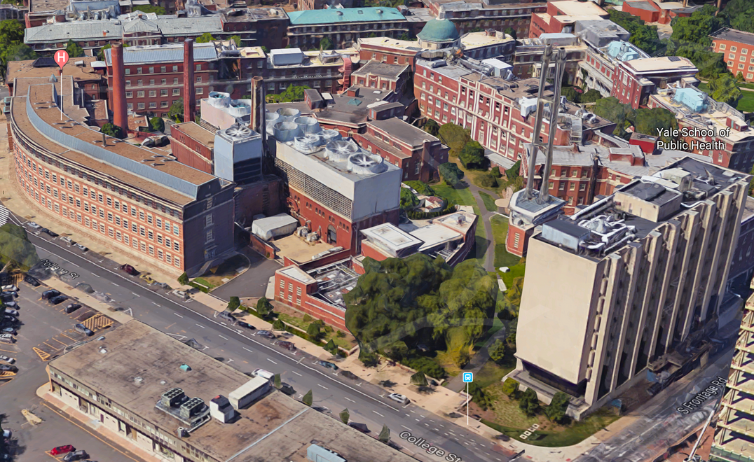
Comments
You are not logged in! Please log in to comment.