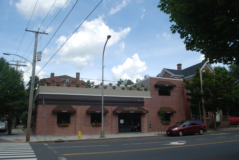
Goodfellas
702 State Street, New Haven, CT
This simple brick building once housed Cowles Tolman's motor car company, a dealer of Franklin automobiles. Since the 1960s, it has been used as a luncheonette and food market, with interspersed periods of vacancy. Around that time, a highway ramp was built from I-91, which empties onto Trumbull Street, the on-ramp connecting to State Street. This was detrimental to the existing urban fabric, and created an isolated triangular patch of surviving buildings, including 702 State Street. Today, the address houses Goodfella's, a popular Italian restaurant that marks the beginning of the Upper State restaurant district.
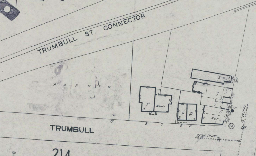
Around the corner, there is a vestigial segment of Trumbull Street, shaded by a sloping viaduct. This block features a preserved lineup of nineteenth century residential buildings, which serve as a reminder of one community that was demolished in the name of 20th century highway expansion projects in New Haven.
Quick Facts:
Year built: Between 1911 and 1923
Architect and/or builder: Unknown
Style: Box structure with Greek Revival elements: a heavy pediment over the entrance and cornice along the roofline
Building materials: Brick
Program (building function): Currently a restaurant, formerly used for auto parts retail, then as a food establishment
Cowles Tolman Franklin dealership, Olympia Luncheonette; unknown owner from 1986-2000; Mark G. Sklarz and James F. Early 2000-2007; One Trumbull LLC 2007-present
The first record of the building is on the 1923 Sanborn map, occupying the addresses 702-704 State Street. The Dana Collection contains a photo of this building from that period that shows the structure as the Cowles-Tolman Franklin motorcars company, presumably a retail outlet for motorcar parts.
In the 1963 Sanborn map, the building’s address changes to 704-706 State Street. In the City Directory from this era, 704 State Street is listed as the Olympia Luncheonette and 706 as the Market Basket and Food Shop, indicating rapidly shifting and presumably unstable occupancy.
702 State Street is the home of Goodfellas Italian Restaurant, which opened in mid 2011. Although the highway exit ramp opposite the building makes its location more of a thruway than a stopping point, its presence is a symbol of a revitalizing State Street, and it marks the beginning of the State Street restaurant district, which includes popular businesses like September in Bangkok and Modern Apizza.
The initial purpose of the building as a retail space for motorcars, as well as its position nearby major interstate junctions and 20th century highway construction projects, corroborates the booming influence of the automobile retail industry in New Haven in the 20th century.
The surrounding urban setting is now dominated by the highway ramp, but 702 State is a crucial building in anchoring the corner of Trumbull Street, connecting it to the restaurant and commercial district of Upper State Street on the north side of the overpass. It is positioned along State Street, which functions as a vital connector within the City of New Haven, spanning from the residential East Rock neighborhood to the vibrant commercial Ninth Square district.
Notably, the 1963 Sanborn map notates 704-706 State in yellow with a broad pink strip through the center. In the original 1923 Sanborn, the building is all pink, which indicates a brick structure. No other buildings are shown with the same notation. The city assessor’s office notes that one exterior wall is clapboard, while the others are listed as brick. This signifies the merging of two distinct buildings.
This structure appears to be a mash-up of a brick commercial building and a wood-framed house, which conflicts with the overlapping portions on the 1963 Sanborn map. One can hypothesize that the house came first and was adapted later and given a unified brick frontage. Beyond that, the building is a relatively unassuming and squat brick structure, alluding to its past use as a functional container for a car dealership. The building has undergone various renovations since then, specifically boasting an expansion from the original wooden house to the street.
Researcher
Alexandra Thompson in 2009
Date Researched
Entry Created
June 4, 2017 at 8:47 AM EST
Last Updated
July 10, 2025 at 4:31 PM EST by naomimain
Historic Name
Cowles Tolman Franklin motorcar dealership
Style
Current Use
CommercialRestaurantEra
1910-1950Neighborhood
OtherTours
State Street StrollYear Built
1911-1923
Architect
unknown
Current Tenant
Goodfellas restaurant
Roof Types
FlatStructural Conditions
Street Visibilities
Yes
Threats
External Conditions
Dimensions
Street Visibilities
Yes
Owner
Ownernishp Type
Private
Client
Historic Uses
CommercialAuto DealershipRetailAutomobile Service/Fuel/Sales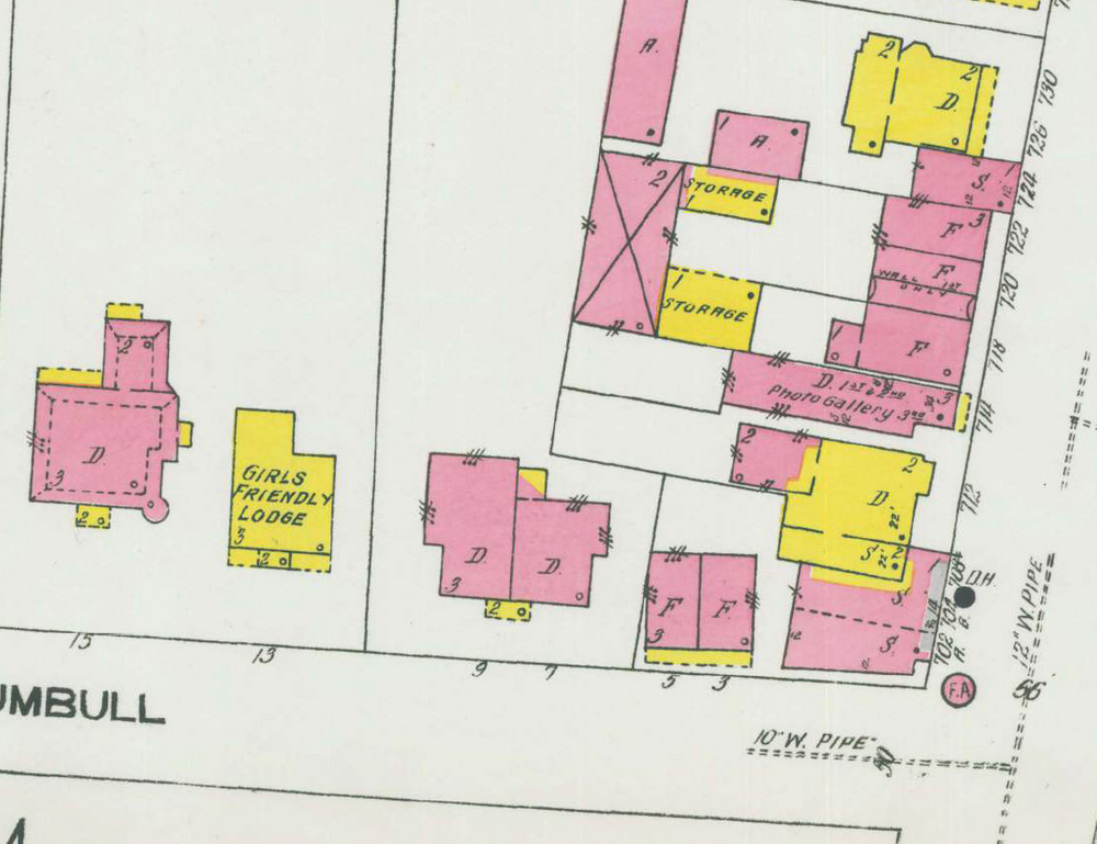
Comments
You are not logged in! Please log in to comment.